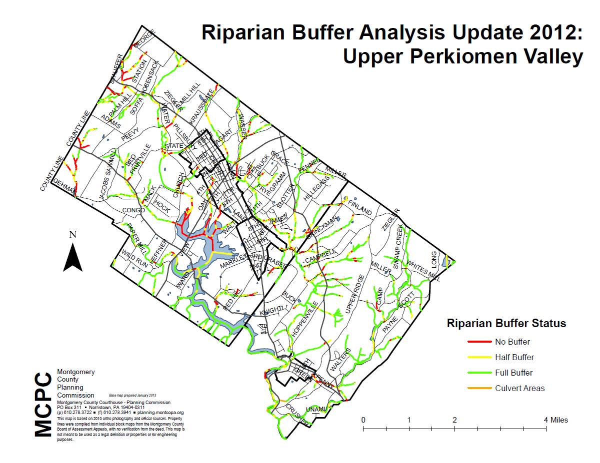
 The Montgomery County Planning Commission partnered with the Heritage Conservancy to complete an update to an analysis of the condition of the riparian buffers along 1,400 miles of stream in the Perkiomen, Wissahickon, Tookany-Tacony-Frankford, etc. watersheds. A full buffer was classified as a section of stream that had at least 50% tree cover for at least 50 feet back from the stream on both sides of the stream. Similarly, a half buffer is when only one side of the stream meets this threshold. Based on this analysis, 81.5% of the stream miles in the Perkiomen watershed have a full or half riparian buffer – the highest percentage of the six watershed analyzed.
Regional Riparian Buffer Map
Upper Perkiomen Valley (PDF)
Municipal Riparian Buffer Maps
East Greenville (PDF)
Green Lane (PDF)
Marlborough (PDF)
Pennsburg (PDF)
Red Hill (PDF)
Upper Hanover (PDF)
Google Earth Layer
**A KMZ file of this data is available that can be loaded into Google Earth so that the status of the riparian buffer can be directly compared to the adjacent land uses. If you would like to receive a copy of this KMZ file, please contact us at mbice[at]montcopa.org**
Natural Lands Trust Presentation
On June 26, 2013, Peter Williamson, Vice President of Conservation Services at the Natural Lands Trust (NLT), shared information on the four main challenges to land stewardship in the Upper Perkiomen Valley region and NLT’s top 5 recommendations to address these issues.
Challenges to Land Stewardship
- Edge – the fragmentation caused by roadways, transmission lines, etc. cutting through forests degrades the quality of the forest habitat and encourages invasive plants and nest parasites.
- Deer – deer thrive in edge forests, overbrowse native vegetation and cause public health and safety issues such as car crashes and Lyme disease.
- Invasive Plants – the spread of invasive plants degrades the natural habitat by outcompeting native plants and decreasing diversity.
- Stormwater – excess stormwater runoff can cause streambank erosion.
Top 5 Recommendations
- Mow Less – NLT recommends mowing only twice a year and not mowing between April 1st and June 15th.
- Control [Manage] Invasive Plants – NLT uses both physical removal and herbicide application to control invasive plants. The growing space should then be filled with native plants.
- Plant Riparian Buffers – a riparian forest buffer with native plants can help ensure streams are cool and nutrient-rich. A no-mow zone along the streambank promotes infiltration of stormwater.
- Use Native Species – always use a wide variety of native species of plants which will in turn support native insects, birds, and animals.
- Keep It Together – minimize the “edge effect” by preserving larger areas of woodlands, meadows, wetlands, etc.
Full presentation: UPVRPC Stewardship (PDF)
Important Links for More Information:
Heritage Conservancy
Natural Lands Trust
Montgomery County Lands Trust
